


Akshay Deoras
Extreme Weather Forecaster
Based on new model runs,11z,14th July
As storms already have fired in CAP deficient area, forecast models are showing a big deal across Minnesota and parts of Wisconsin.
Storms have already fired in SE North Dakota in the warm front and will brace in Minnesota and WI by post afternoon period
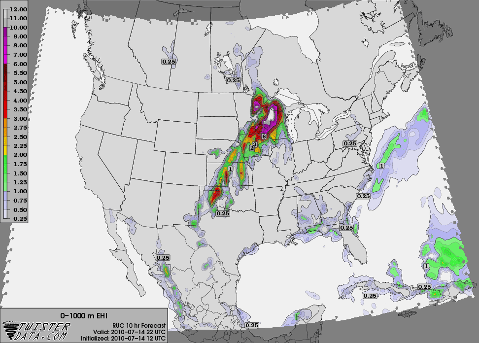
RUC models are indicating a very high level MCAPE will develope ranging to 9000J/Kg will develope at the IOWA-Minnesota border which will spread towards north later of the day. With the progressing warm front, severe storms will move around with a linear fashion increasing the threat for HIGH WINDS AND HAILS
SPC HAS MENTIONED A 60% RISK OF 60KT AND GREATER WIND IN 25 MILES OF A POINT...
SHEARS WILL BE SUFFICIENT ENOUGH TO TRIGGER TORNADOES AND NOW I AM EXPECTING ATLEAST A DOZEN TORNADO
--
Akshay Deoras,
akshaydeoras.blogspot.com
metdweather.blogspot.com
P- 94223-13055
--
Akshay Deoras,
akshaydeoras.blogspot.com
metdweather.blogspot.com
P- 94223-13055
No comments:
Post a Comment