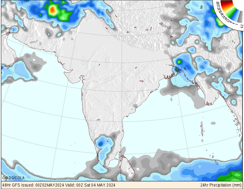
 ABOVE-THE GFS,700MB VERTICAL VORTICITY AND PRECIPITATION MODEL SHOWING HEAVY RAINS IN SOUTHERN GUJARAT. THE ABOVE FORECAST IS OF SUNDAY,4TH JULY 2010
METD WEATHER,
Akshay Deoras,
Extreme Weather Forecaster
Extremely heavy rains gripped Mumbai city on Saturday and has disrupted the traffic and life of people. This is happening as the Low pressure from Bay of Ben
gal which recently centered over Maharashtra and Chattisgarh speedily went Westward and is now centered over Daman diu. This low pressure is extensively pulling moisture from the moisture rich Arabian Sea which is causing Very heavy rains in Mumbai,South-eastern Gujarat and areas of North of Mumbai.
GFS,00z has been showing more than a 100mm rains in Mumbai. As the mid and lower levels of atmosphere over mumbai and densely rich with moisture, heavy rains in few intervals are happening
Forecasts says that more rains will hit Mumbai city on Saturday and will be heavy by Saturday night, on Sunday, comparatively less rainfall in Mumbai and Western belt though can trigger some problems due to afternoon high tides
Rains will be very heavy on Southern Gujarat areas
like Rajkot,Baroda, Surat etc.
Meanwhile, In interior Maharashtra rains will be quite heavy on Sunday
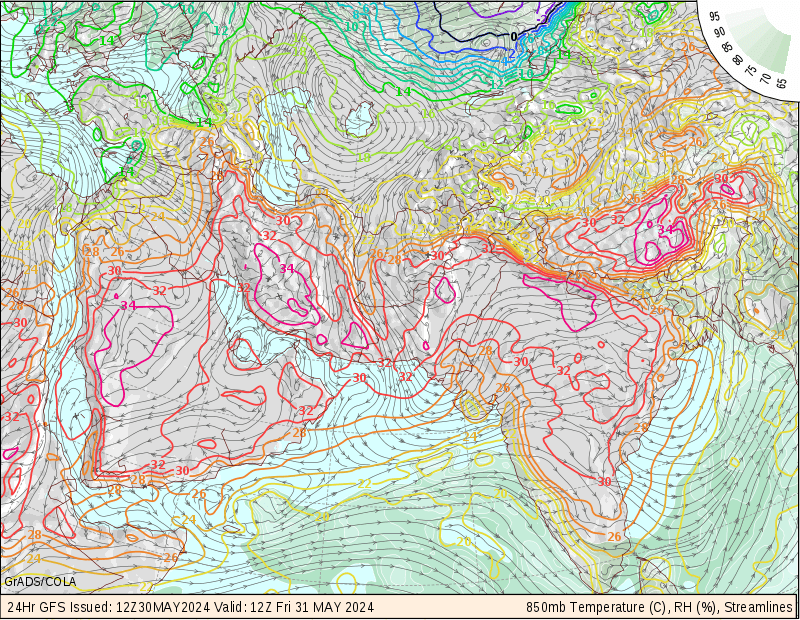
BELOW- THE 850MB MAP SHOWING THAT LOW PRESSURE AREA IS CENTERED NEAR SURAT,GUJARAT. YOU CAN SEE HOW MOISTURE IS GETTING PULLED INWARDS AND FAVOURING THE MONSOON ADVANCEMENT
No comments:
Post a Comment