METD WEATHER
Akshay Deoras
Severe Weather Forecaster
Multiple rounds of severe weather are happening in the US prominently Central parts. The above 300mb GFS 09z shows exiting trough from East Central US. The trough had provided some thunderstorms in recent at Central parts. The plot also shows the approaching short wave trough currently over the Western US. The shortwave trough is expected to dig in the central US by Friday evening hours into Saturday with large amplified flow exceeding 120kt.
THURSDAY-

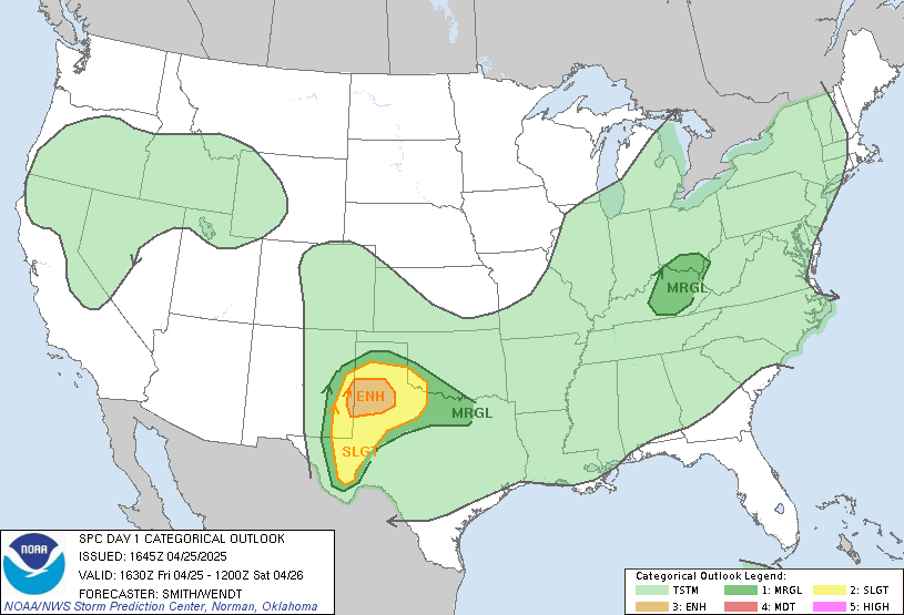
The pressure gradient over Gulf of Mexico and Central US is forcing the winds to carry moisture inwards. The RUC 05hr shows dewpoint over 65F across Western Oklahoma,Western Kansas and Western parts of Texas. As the day time heat coupled with instability adds up Severe Thunderstorms shall fire East of the dryline in Texas,Oklahoma and stretching upto Kansas. During the afternoon period, large hails shall be likely across Western Kansas and Western Oklahoma. By evening hours, ground helicity will be favored over 200-300 units across a region particularly Eastern Texas Panhandle-Western,North-Western Oklahoma where the Hodographs are indicating nice curvatures favoring for tornadoes. Its very likely that isolated supercells will form and shall be capable to produce tornado***
NIGHT TIME TORNADOES ARE LIKELY AFTER 21Z ESPECIALLY ACROSS NW OK,WEST OK,EASTERN TX PANHANDLE AND WRN KS******

FRIDAY
The Upper level pattern combined with surface level analysis indicates the second round of severe weather across the same area stretching more North East wards.
The Instability shall be Moderate i.e over 3000 J/Kg across Southern,Central Oklahoma prominently with very good lifting depicted by LI over -7 to -8 in southern and central OK. However the Wind shears shall be a bit limited as per the NAM models. The 0-1km Hel and EHI shows weak values supporting not very strong tornadoes. However the models keep changing and hence its mandatory to keep an eye on the weather
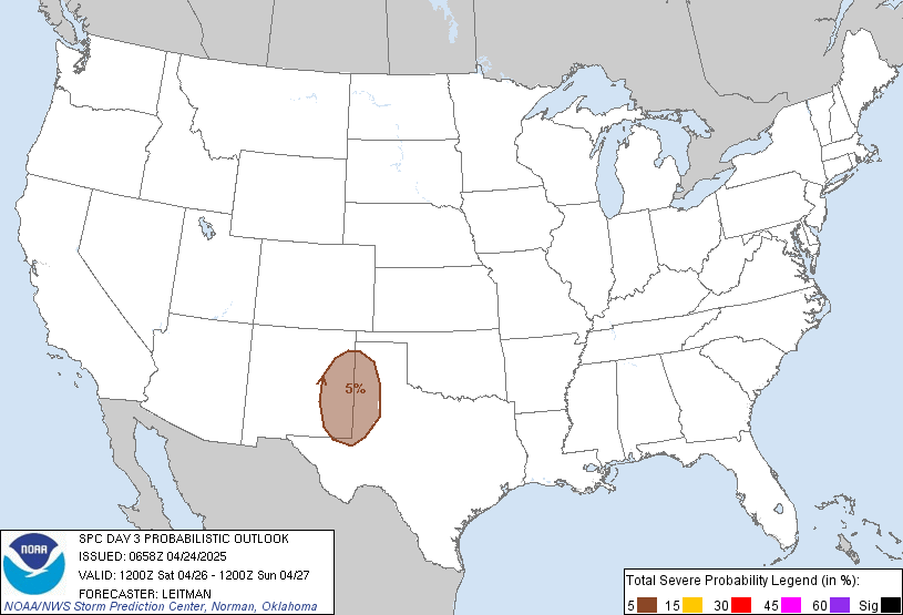
***MODERATE RISK : SATURDAY***
Possible HIGH RISK?
With more Eastward progression of the trough, the energy required for strong weather avails on Saturday.
The Warm moist sector shall be a widespread as the SFC low over Western Kansas by 14/12z amplifies the LLJ stretching over 60kt at peak and causing a Robust incursion of moisture from the Gulf of Mexico into the Texas,Oklahoma,Kansas particularly causing elevated dewpoint over 70F favoring for strong convection. The best lifted indices shall be across a region stretching from North Central TX to SRN,Cent OK amidst CAPE values over 2000J/Kg.


Supercells are likely in the areas as being depicted by the GFS Bulk Shear over 50kt. Not much of Severe Weather is expected by mid or late afternoon as the trough will take some time before it reaches the concerned area. Also the developing wind shear shall blast in a period stretching from late afternoon into night hours across the region. Considering the favored combination of instability and powered by steep lapse rates and overall curvatures in the Hodograph, the mentioned Moderate Risk AREA will witness strong thunderstorms and some capable of producing tornadoes and hails prominently with strong winds and localized flooding due to heavy rains.
Considering the status of LLJ, it might not be wrong to see if the MDT area or slightly East of it is upgraded to High Risk area till Saturday.
So Stay TUNED FOR UPDATES


